
What's proposed
Syncline Energy has worked extensively with local landowners to develop a unique transmission proposal, using public land along the Calder Freeway and privately owned cropping and grazing land.
The point-to-point High Voltage Direct Current (HVDC) technology is proven to improve network stability and maintain higher energy transfer than standard overhead transmission towers, creating a more robust grid for Victoria.
Proposal objectives

Critical infrastructure for Victoria

Optimised transmission
route

Delivering a stronger network at a lower cost

Economic benefits aligned with government policy

Building strong social licence for transmission
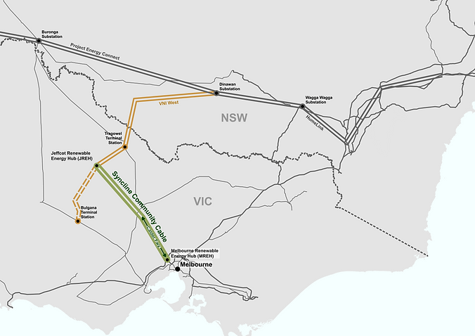
Syncline Community Cable
concept plan
In this location and for this purpose, undergrounding makes sense.
The proposal represents a new transmission ‘superhighway’ to western Victoria, connecting the high energy-demand centre of Melbourne directly to renewable energy generation in the northwest and connecting lines to NSW.
It offers a better alternative to traditional overhead lines, and aims to build social license, resulting in fewer visual, fire, and reliability risks.
Importantly, it delivers a power line that is more compatible with agriculture, and once constructed, the land can be used for cropping and grazing as before.

How the optimal engineering solution was developed
A direct north-south line was first identified as the ‘missing link’ by grid planners in 2010. Due a decade of land access delays in Victoria and cost blow-outs in other States, it is now clear that overhead powerlines are just too expensive and won’t be available to plug that gap.
To resolve the challenge of the missing link for Victoria, Syncline built an engineering model of the network in PSS®E, the software used by the Australian Energy Market Operator and VicGrid to assess energy flows. Syncline then set about identifying the optimal technology and connection points.
This model identified the Syncline Community Cable route as the optimal solution to alleviate Victoria’s existing network constraints by increasing flows between NSW and Victoria and by increasing and better distributing the State’s renewable energy hosting capacity.

Route selection
The project has been developed via a multi-staged route refinement process, including initial route investigations, multi-criterion assessment and micro siting.
1
Initial route investigations
(complete)
The connection points of the route were determined as MREH and a broad area of farming land near Charlton.
Several exiting linear corridors were identified with the Calder Freeway median identified as the most appropriate option with the advantage of being direct, already disturbed, having relatively few biodiversity values, and offering an established corridor with good buffers from residential land.
2
Multi-criterion assessment
(complete)
From the Calder Freeway, a multi criterion constraints assessment was undertaken to identify a route from Bendigo to Newbridge and then from Newbridge, north of Bridgewater on Loddon and Inglewood then west to Charlton south of Wedderburn.
3
Micro siting
(complete - subject to final engineering design and technical assessments)
The preferred route has been refined over time. Changes have been made in response to engineering requirements, technical assessment findings and landowner engagement. The route is now largely agreed, but may be micro sited further following final engineering design and technical assessments.
A number of measures have been implemented, in addition to micro-siting, including reducing the width of the construction corridor where ecological or cultural heritage values are known to occur and using horizontal boring or other trenchless construction methods to avoid sensitive areas entirely.
The route has been re-aligned around significant ecological or cultural heritage values and where the construction corridor has been narrowed or horizontal boring or other trenchless construction methods are proposed.
Land types
Syncline Energy has worked extensively with local landowners to develop a unique transmission proposal, using public land along the Calder Freeway and privately owned cropping and grazing land.

Land type
Calder Freeway
Approximately 100km of the route is proposed within the Calder Freeway median and the old-Calder Highway (Harmony Way) through Harcourt.
This section will be mostly under the existing road pavement and gravel shoulder. Where the route crosses other roads, the construction methodology will be determined in consultation with the relevant authority.
Land type
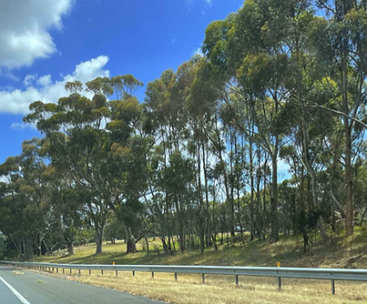
Vegetation and waterways
The route traverses a number of vegetated areas including waterways with established riparian corridors.
In these locations, horizontal boring or other trenchless construction methods will be used to minimise impacts.

Land type
Agricultural land
Once exiting the Calder Freeway, the route predominantly traverses broad acre grazing and cropping farms.
Each landowner has been consulted regarding the route within their property. Where possible, the route has been micro sited to respond to landowner preferences (e.g. running along fence lines, avoiding infrastructure).
Next steps
Subject to necessary approvals over the next 12 months, construction of the Syncline Community Cable can begin in late 2026 and become operational in 2031.
Planning and environmental assessments have now commenced for the Syncline Community Cable to support the approvals required and inform the design and construction approach.